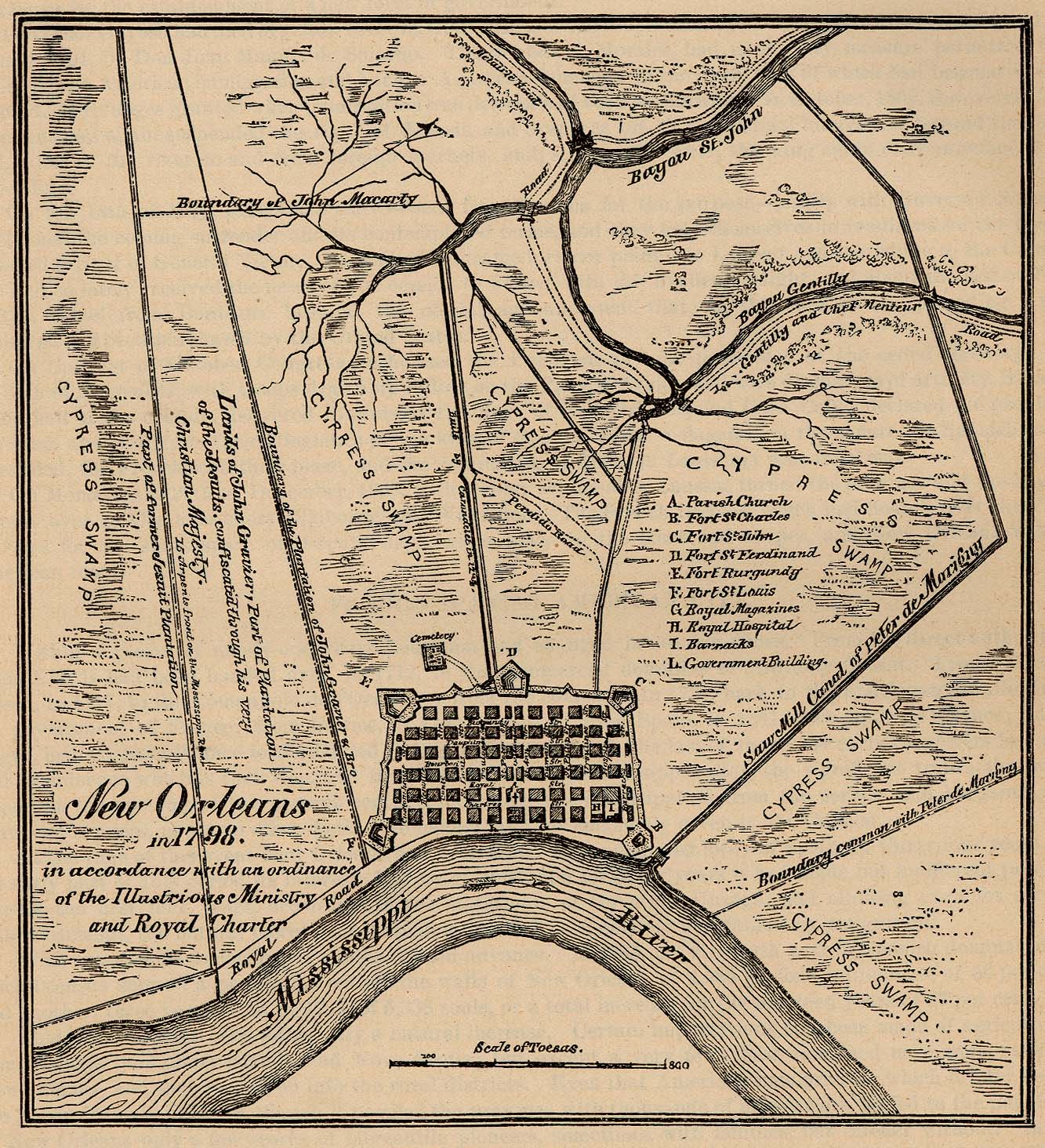
Take a look at this historic map of New Orleans:
http://www.lib.utexas.edu/maps/historical/new_orleans_1798.jpg
Questions for map:
How many years ago was this map made?
What is a cypress?
Watch the video clip on Fresh Water Communities
located at this link:
http://www.nhptv.org/natureworks/nwep.htm
Pay close attention to the section on wetlands.
What has happened to most of the world’s wetland
areas?
If wetlands act like “giant sponges that keep
areas from flooding” what do suppose happens
when cities are built on wetland areas?
What animals live in the cypress swamp?
Do any of these animals live where you live?
Click on the link to read more about a white tailed
deer.
http://www.nhptv.org/natureworks/whitetaileddeer.htm
Read this poem by George Oppen
http://unix.cc.wmich.edu/~cooneys/poems/oppen.poem.html
Questions/Activities
What is a psalm?
Why do you think the poet named this poem “Psalm”?
What is the feeling expressed in this poem for the
wild deer?
What are the deer doing? Where? How are they described?
What are the most interesting images in the poem?
What are the words you like?
Make a list the most interesting and unusual animals
that live near you. Be specific—for instance,
instead of listing “birds” say which
ones: herons, crows, hummingbirds…
How do you feel when you meet a wild animal? What
do you think about?
When and where did you and this animal encounter
each other? Can you tell a story about it or write
a poem like George Oppen’s poem that starts
by describing what the animal is doing and what
they look like?
What is a bayou?
http://www.m-w.com/dictionary/bayou
What is the original language(s) of the word?
You can see the bayou system clearly on this map:
http://www.lib.utexas.edu/maps/united_states/gulfport_1982.jpg
(remember to click on the page and use the zoom
box.)
When was this map made?
Does this map give you an idea of the amount of
water and wetlands in the New Orleans area in recent
times ?
Find and name 10 bayous in the New Orleans area.
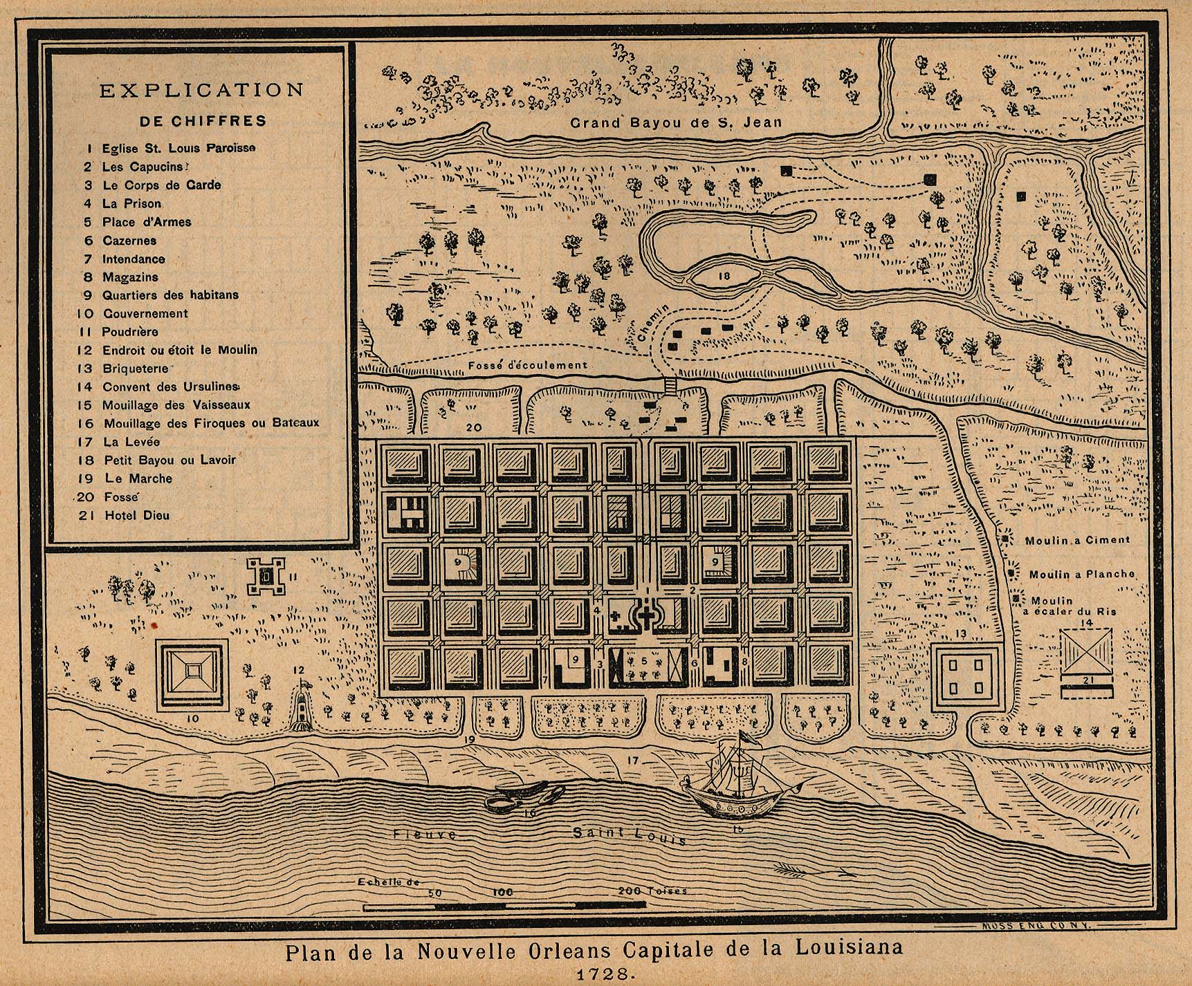
THE FRENCH QUARTER
Examine this historical map of the Plan de la Nouvelle
Orleans Capitale de Louisiana: http://www.lib.utexas.edu/maps/historical/new_orleans_plan_1728.jpg
This is the map of the first European settlement
in the area we now know as Southern Louisiana.
Which European nation built this settlement?
Can you recognize any of the words on the map?
What is the name of the river on this map?
What is this river’s
name today?
The settlement has a church at its center. Read
about the history of this church here:
http://stlouiscathedral.org/historye.htm

