|
|
|
|
|
|
|
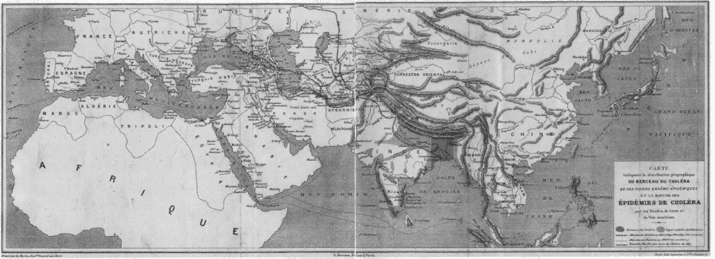
Figure I.1
Map indicating the geographical distribution of the sources of cholera and "the progress of cholera epidemics" by land and sea routes. The progression by land is shown by the line with
small vertical marks (18231847), by sea in 1865 via ship, and new progressions overland from 1892. Note the sea routes marked between Mecca and Marseilles.
Source: A. Proust 1892. |
|
|
|
|
|
|
|
|
called at ports on the way back from Mecca had to follow a period of quarantine during which anyone infected would become symptomaticthus emulating the slower timeline of horse or camel travel (see figure I.1). |
|
|
|
|
|
|
|
|
After quarantine, one was given a "clean bill of health" and allowed freedom of transport. This was a costly delay for the ships, and so a black market in clean bills of health appeared shortly thereafter . . . . The problem of tracking who was dying of what and where on earth became a permanent feature of international bureaucracy (see figure I.2). |
|
|
|
|
|
|
|
|
Constructing such a list may appear to be to us a comparatively straightforward task, once the mechanisms for reporting were in place. |
|
|
|
|
|